


1
2
3
4
5
6
7
8

Images featuring the physical and human geography of the Crescenta Cañada Valley.
Click on an image to see a larger view with captions. To download it for educational use, please right-click on the image.
Orange groves and home of Edward Dunham
This fine fourteen-room Victorian mansion surrounded by orange groves could reportedly be seen from Pasadena. It was located on the corner of Palm Drive and Michigan Avenue (now Foothill Boulevard.) Its owner, Colonel Edward Dunham, was a successful hotel operator.
Photo by Jarvis of Pasadena, circa 1890s.
Water from Halls Canyon (Earl's Canyon), before 1893
A flume constructed of redwood carries water out of the top of the waterfall to the Cañada valley. The flumes connected to concrete pipes which delivered water to reservoirs.
Photo by Charles Pate. Image property of the La Cañada Congregational Church (Pate 191).
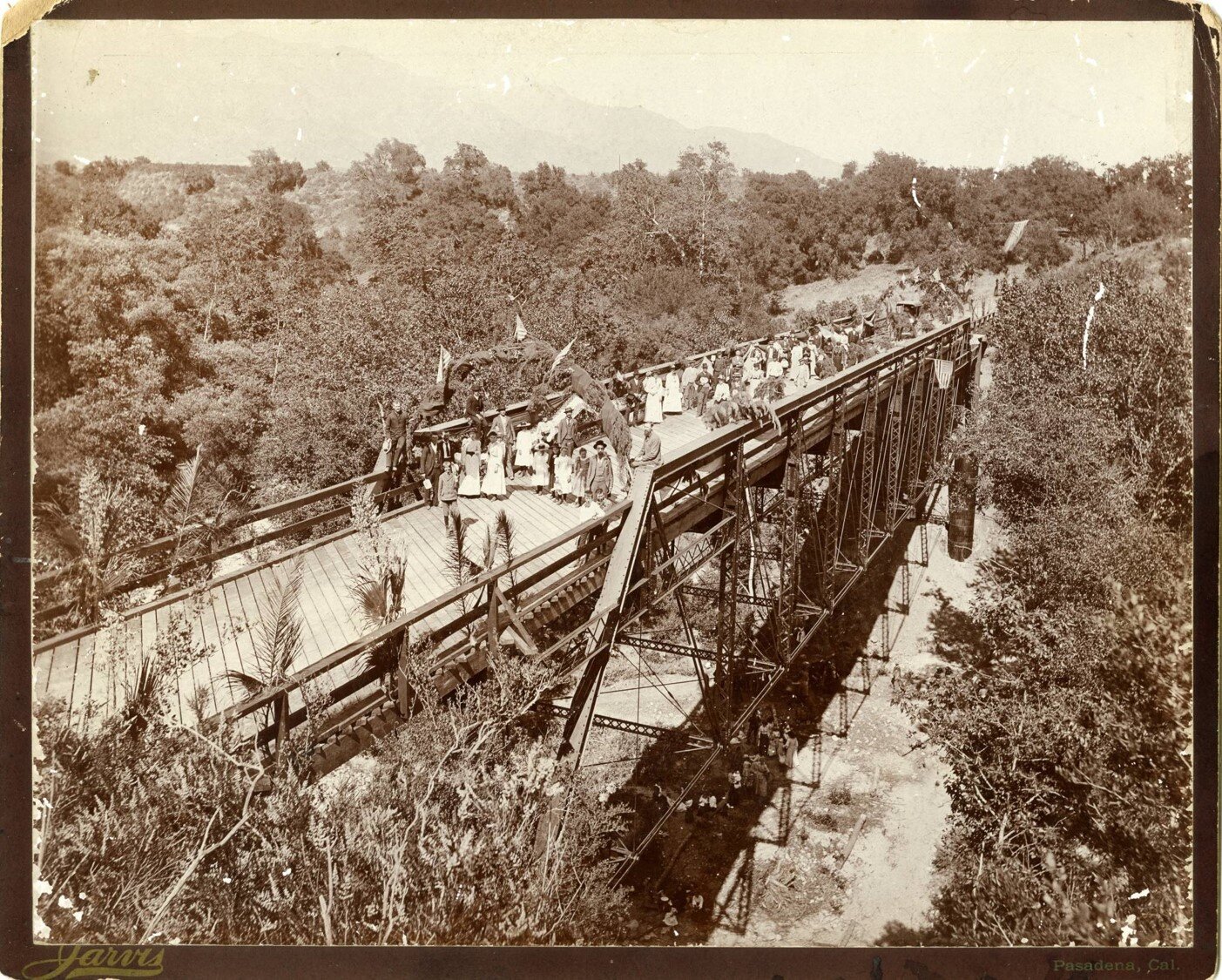
Opening celebration of bridge across the Arroyo Seco, 1893
In May 1893, the first bridge across the Arroyo Seco (near Devil’s Gate) opened. This was an important milestone connecting the rural Crescenta Cañada Valley to the city of Pasadena.
Photo by Jarvis of Pasadena
The La Cañada Valley, as seen from Flintridge, circa 1900
Photo by Charles Pate. Image property of the La Cañada Congregational Church (Pate 104).
The Crescenta Cañada Valley, circa 1907
Looking northwest toward the San Gabriel Mountains
Devil's Gate Dam, circa 1920
The Devil’s Gate Dam, built in 1920, was the first of the Los Angeles County Flood Control District's dams. It replaced the 1893 bridge across the Arroyo. The dam was designed for both flood control and water conservation. It also served as the main road between La Cañada and Pasadena for many years.
210 Freeway, built between 1969-1972
Construction of the 2 freeway, 1973-1978
In 1978, the portion of State Highway Route 2 from Route 134 in Glendale to Route 210 in La Cañada Flintridge was officially designated the Frank Lanterman Freeway, in honor of California State Assemblyman Frank D. Lanterman.